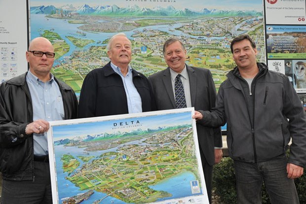
The Delta Chamber of Commerce unveiled a geopictorial map of Delta this week that showcases the municipality's growing economic regions and opportunities.
Produced by Mountain Media, the new map features a unique, colourful illustration showing enhanced buildings, landmarks and landscapes of Annacis Island, Ladner, North Delta, Tilbury and Tsawwassen. Award-winning
Montreal artist Jean-Louis Rheault created the artwork.
"This new map will be a great asset for promoting Delta's vibrant businesses and economic regions," said Delta Chamber of Commerce chair Orv Nickel.
"Companies will benefit from greater visibility as both posters and presentation folders of the map will be used throughout our community."
Two large signs have been installed at the Delta Chamber of Commerce and Delta Visitor Centre, and at the visitor pullout near the Tsawwassen ferry terminal.
The creation of the Delta Geo-pictorial map was made possible by a cooperative effort between the Delta Chamber of Commerce and Delta Visitor Centre, Mountain Media, Port Metro Vancouver and partners from the private sector.


