A new concept plan proposed for the River Road West area of Ladner has local residents concerned.
The city’s plan is to address long-term flood protection while creating a series of roadway changes from 34th Street to Ashbury Place.
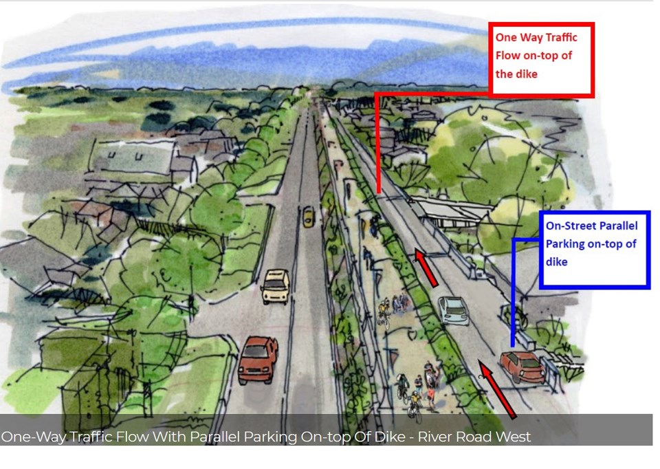
The proposed changes include traffic calming in the form of raised intersections to reduce speeding on River Road West, a provision for vehicle access and resident parking on a dike roadway, a continuous multi-use pathway allowing connections to the Westham Island Bridge and Brunswick Point, improved resident access through raised intersections to allow for a more gradual transition to the dike roadway as well as consolidating access points by reducing the number of driveways.
The ultimate goal is to raise the dike by approximately 0.6 metres by 2050 with provisions to raise the dike a further 0.6 meters by 2100.
Two years ago, city council agreed with a staff recommendation that the city enter a memorandum of understanding with the Ministry of Forests, Lands, Natural Resource Operations and Rural Development for a phased flood protection strategy.
It’s to provide clarity for residents that own property along the river as well as provide staff sufficient time to complete a comprehensive study of the corridor.
Many properties in the River Road West area, which encompasses Port Guichon, are shallow and located outside Delta’s dike system.
An engineering department report at the time explained that when provincial dike guidelines were amended to address climate change and dike seismic design guidelines were established, it was determined the entire dike system would need to be raised significantly by 2100.
Delta’s engineering department suggested that a phased approach be implemented.
However, property owners raised the alarm, saying the situation left them with great uncertainty as they’re likely unable to redevelop or rezone their properties because the city will need part of their land.
The city is now saying the new conceptual design were developed in an effort to avoid additional private property requirements by ensuring the proposed flood protection improvements would be undertaken within existing road dedications and statutory rights-of-way.
Asking that the process be put on hold until adequate consultation with residents can be held, a recent letter to council outlined a number of concerns regarding the proposed concept’s design.
“It appears the river side properties will be absorbing the brunt of the change that benefits other residents but negatively impacts the use and enjoyment of those residents living on the river side,” the letter states.
The city also notes that given the costly nature of the project, significant federal and provincial funding assistance will be required to move the final design forward. However, it is important to have a design ready, should funding become available.


