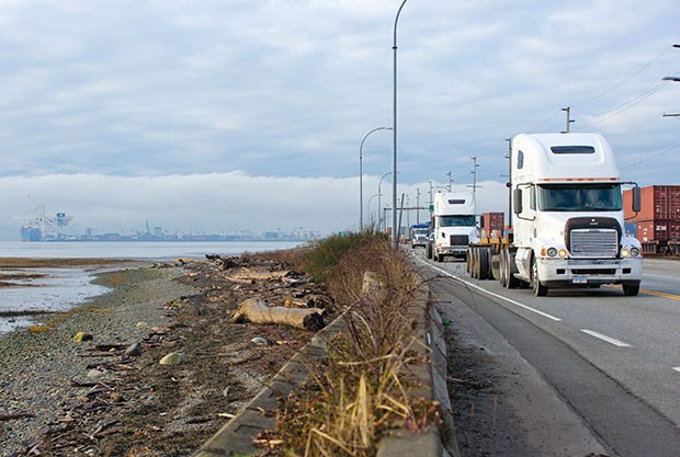
Port Metro Vancouver could end up creating a much bigger man-made island at Roberts Bank than most people realize.
That's the concern raised by opponents of port expansion now that the port authority's new Land Use Plan has redesignated an area adjacent to the causeway.
Finalized and made public late last year, the updated plan outlines what the port intends to do, in the long-term, with the land and water under its jurisdiction.
As far as Roberts Bank goes, the water on both sides of the causeway, from the shoreline of the Tsawwassen First Nation to the existing terminal, as well as the future Terminal 2, had been designated as "Port Marine/Port Water." The new designation changes that "Special Study Area."
When asked about the future of that area, the port authority would only state, "Special study areas mean Port Metro Vancouver will engage in additional study, consultation and planning to determine their future use, and any change to their designation would be made through a Land Use Plan amendment. Until this is completed, the current use remains unchanged."
A port spokesperson told the Optimist there's no timeline on when change would be considered for the Roberts Bank study area and it could take years for anything to happen, if it does at all.
That doesn't offer much comfort to Against Port Expansion's Roger Emsley, who fears the port might already have plans to fill in the area to create a new man-made island for industrial uses once Terminal 2 is
approved. "That change (in designation) is significant and basically what you used to have with the Fraser River Estuary Management Plan, FREMP, they had mapped that whole area and labeled it as conservation and environmentally sensitive. Now you've got FREMP disbanded and the port has taken over what FREMP used to do, and here they are changing the emphasis on that area," Emsley said.
"Who knows what the end game plan is; maybe to fill that whole thing in and just make it a huge industrial area. Even if you take the piece along the causeway on the right hand side going out to the existing port, there's an area all along there that is biofilm, and that's what the western sandpipers feed on.
"Yet they're planning on expanding the width of that causeway. It will destroy that biofilm and there is a tipping point... it's essential to that population. We're ramping up contacts to various international bodies and making them aware what's going on."
Delta South MLA Vicki Huntington is convinced a massive island will be created if the port gets its way, but she said the port wants to keep quiet for now on whatever plans are being devised.
Richmond Coun. Harold Steves, a longtime critic of Port Metro Vancouver, is also concerned about the port's plans for a socalled study area that's now Richmond agricultural land.
As far as what's in store for Roberts Bank, he said the people of Delta should be concerned a massive industrial hub would be created that's even bigger than what's being talked about now.
That includes the Delta study area being filled in, farmland potentially converted for warehousing as well as petroleum products coming by rail or pipeline to Roberts Bank.
A recent report to Delta council noted that despite Delta's request during consultations that the water area on both sides of the causeway be designated as conservation, the port kept it as a special study area.
When the Land Use Plan was still in draft form a year ago, a port official in an interview said nothing has been planned for the new study area at Roberts Bank, but the port had been talking with the TFN about the future of the site.


