An advanced design is to be completed in 2024 for Delta Nature Reserve/Delta South Surrey Greenway project.
That’s according to a recent Metro Vancouver staff report to Regional Parks Committee on planned and ongoing initiatives for this year.
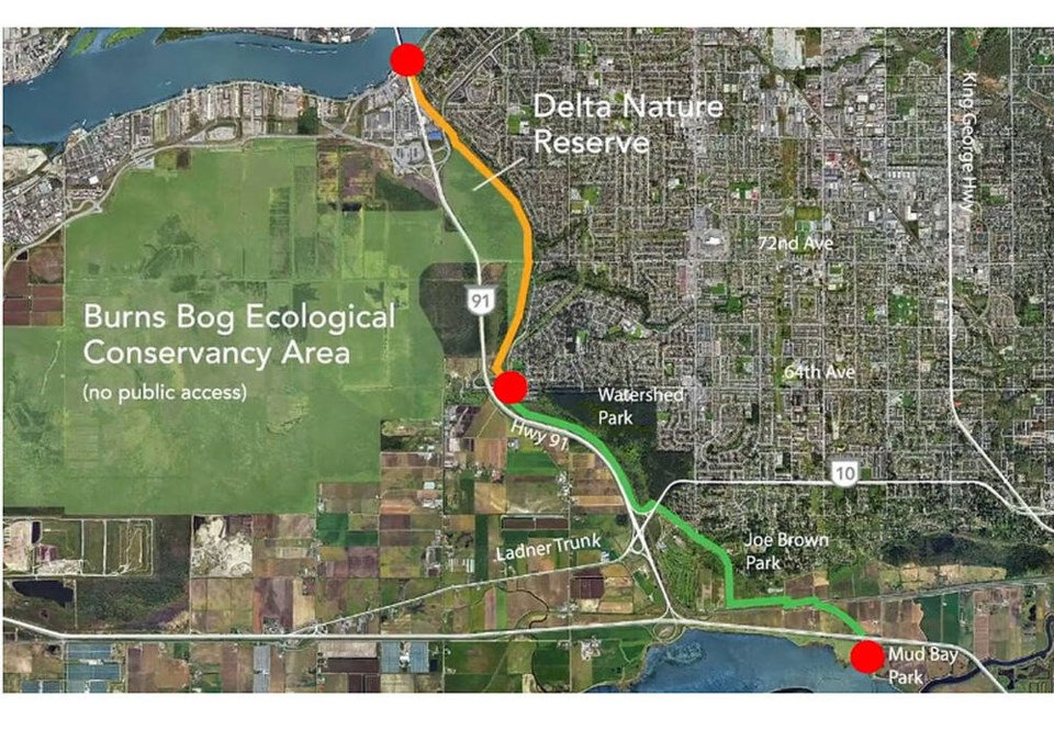
The greenway will a multi-use trail and greenway corridor extension.
The first phase of the greenway currently runs from Mud Bay in the south to 64 Avenue at its northern end. Along the way it provides connections to the Boundary Bay dike trail in Delta, Mud Bay Park and Joe Brown Park in Surrey as well as Watershed Park in North Delta.
The future extension would run from 64 Avenue north to the Alex Fraser Bridge, and potentially to the Fraser River.
The section of the current greenway between Nordel Way and 72 Avenue functions as an access trail to the Delta Nature Reserve, which is adjacent to the Burns Bog Ecological Conservancy Area that will remain closed to the public.
Meanwhile, Metro Vancouver is also working on new plan for the nature reserve, a plan which is to include portions of the Burns Bog Ecological Conservancy Area.
The regional district noted considering these areas of parkland together will create a more cohesive plan that ensures coordinated resource management and integrated visitor experiences.
Metro staff three years ago completed a background report and the first phase of public engagement, which showed strong support for protecting the ecological value of the lands as well as a desire for more educational opportunities, improved access and additional park amenities.
“The Delta Nature Reserve is part of the Burns Bog Ecological Conservancy Area and has long been identified as a key component of the bog lands to be open to the public. Nearby portions of Burns Bog east of Highway 91 include a large paved area, previously used as a peat plant. Both areas have opportunities for habitat protection and enhancement as well as recreation and education,” the regional district explained in a previous report.


